 |
|
| Home | |
| Victor Hess | |
| Auger Project | |
| Coord.systems | |
| Terrestrial | |
| Galactic | |
| Celestial | |
| Space weather | |
| Unix Time | |
| Projects | |
| Ask me | |
| Contact | |
From 3D to 2D
What happens when you flatten an orange peel into a plane?
|
Displaying the 3D object Earth on 2D paper is not trivial because the globe has a curved surface which has to be flattened into a plane. |
|
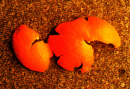
| Any flattening of a curved plane (projection into a 2D plane) will inevitably involve a distorted image. The distortion can involve the shape, area, angles, etc. You can see this phenomenon when flattening an orange peel (Figure 1). | 
Figure 1: Flatten orange peel into a plane
image credit: http://krygier.owu.edu/krygier_html/geog_222/geog_222_lo/geog_222_lo13.html |
Some common map projectionsThere are different methods to represent the continents in a 2D plane. Take a look at the following images and compare the shapes of North America. |
|

Figure 2: Various map projections
image credit: http://geology.isu.edu/geostac/Field_Exercise/topomaps/images/projections.jpg |
|
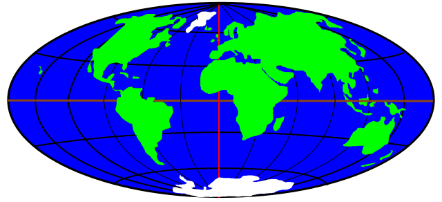
The Aitoff projectionDavid Aitoff introduced a widely used method to transform a 3D globe to a 2D map. A closer look at the distorted shape of the shown world map (Figure 2) reveals that this 2D projection is stretched into a 2:1 ellipse. Due to the distortion the world map remains only equidistant along the central meridian and the Equator which are represented by straight lines in Figure 3. One can see in Figure 3 that the distances between the longitudes are equal along the Equator whereas the latitudes are equally distant along the central meridian. The central meridian is exactly half the length of the Equator. |
|

Figure 3: The world in Aitoff projection
|
|
An Aitoff map of the sky - conversion from spherical to planar coordinatesScientists use the Aitoff projection frequently to create maps of the whole spherical sky. Similar to the terrestrial coordinates, the galactic coordinate system can be transformed into planar x and y coordinates of a flat surface with the following formulas: |
|
| Aitoff-latitude | Aitoff-longitude |
| Φ: | galactic latitude |
| λ: | galactic longitude |
| π: | a mathematical constant which is approximately equal to 3.14159 |
| α: |  |